Sports

Trekking

Giants trek - Stage 7
Between Switzerland, France and Italy
49.081 km 2905 m D+ 3104 m D-
See the itinerary on the geobrowser
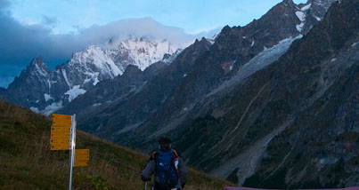
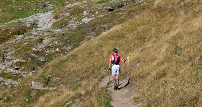
From Rey, go up to the Champillon mountain pasture (2057 m) and continue on towards the Létey-Champillon mountain hut (2375 m) and the Champillon Pass (2709 m). Go down to Ponteilles Damon (2046 m) and Desot (1807 m) and continue on towards the village of Saint-Rhémy (1621 m). Take the path that leads to the village of Laval (1624 m) and follow the tarmac road through the neighbourhoods of Couchepache and Mottes, then go up to the Merdeux Desot mountain pasture (1950 m) and then Tsa de Merdeux (2273 m). From the Lac de Merdeux plateau (2540 m), go up to the Malatrà Pass (2925 m), and from there down to the Bonatti mountain hut (2025 m) and along the long balcony that looks out over the Val Ferret and leads to the Arminaz mountain pasture (2009 m). Continue towards the Bertone mountain hut (1989 m) and descend towards the Val Sapin and Villair Superiore (1389 m). From there you can reach the church square in Courmayeur (1224 m).
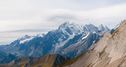
Don't miss: By basin - view over the Mont Blanc range - Great St. Bernard Pass, with the hospice and the St. Bernard dogs - Via Francigena - neighbourhood of Saint-Rhémy - Jambon de Bosses (DOP)
Suggested program: three days
First day: from Rey, Ollomont, to Saint-Rhémy-en-Bosses (19,699 km)
D+ 1452 m - D- 1225 m
Trekking time: 7h30
First day map
Second day: from Saint-Rhémy-en-Bosses to the Bonatti mountain hut (17,480 km)
D+ 1313 m - D- 903 m
Trekking time: 7h30
Second day map
Third day: from the Bonatti mountain hut to Courmayeur (11,901 km)
D+ 140 m - D- 976 m
Trekking time: 3h50
Third day map