Vai al contenuto principale

Sito ufficiale del turismo in Valle d'Aosta

IT
  • DE
  • EN
  • ES
  • FR
Lovevda – Sito ufficiale del Turismo in Valle d’Aosta
Logo Regione VDA
  • Home
  • Sport
    • Sci Snowboard
    • Fuori pista
    • Sci alpinismo
    • Sci nordico
    • Racchette neve
    • Ghiaccio
    • Sport estate
    • Altri sport
  • Eventi
    • Trova gli eventi
    • Trova le mostre
    • Escursioni e visite guidate
    • Corsi e laboratori
  • Bambini
    • Gioco
    • Sport
    • Cultura
    • Natura
    • Eventi bambini
    • Laboratori
  • Benessere
    • Terme di Pré-Saint-Didier
    • Terme di Saint-Vincent
    • Centri benessere
  • Cultura
    • Architettura romana
    • Castelli
    • Chiese e santuari
    • Musei
    • Tradizione
  • Enogastronomia
    • Vini
    • Prodotti
    • Aziende visitabili
    • Eventi del gusto
    • Ricette
    • Dove mangiare
  • Natura
    • Parco Nazionale Gran Paradiso
    • Parco Mont-Avic
    • Riserve naturali
    • Giardini botanici
    • Natura 2000
    • Miniere
  • Offerte
  • Trova sulla mappa
  • Luoghi da scoprire
    • Località
    • Aree turistiche
    • Giganti delle Alpi
    • Funivie verso i 4000
  • Come arrivare
    • In auto
    • In treno
    • In autobus
    • In aereo
  • Prima di partire
    • Meteo
    • Webcam
    • Bollettino discesa
    • Bollettino fondo
    • Come muoverti
    • Depliant
    • Accessibilità
  • Dove dormire
    • Strutture ricettive
    • Locazioni turistiche
    • Prenotazioni on line
  • Itinerari
    • Culturali
    • Del gusto
    • Dello spirito
    • A piedi
    • In bici
    • In moto
    • Con racchette
    • Itinerari sportivi
    • Home
    • Sport
      • Sci Snowboard
      • Fuori pista
      • Sci alpinismo
      • Sci nordico
      • Racchette neve
      • Ghiaccio
      • Sport estate
      • Altri sport
    • Eventi
      • Trova gli eventi
      • Trova le mostre
      • Escursioni e visite guidate
      • Corsi e laboratori
    • Bambini
      • Gioco
      • Sport
      • Cultura
      • Natura
      • Eventi bambini
      • Laboratori
    • Benessere
      • Terme di Pré-Saint-Didier
      • Terme di Saint-Vincent
      • Centri benessere
    • Cultura
      • Architettura romana
      • Castelli
      • Chiese e santuari
      • Musei
      • Tradizione
    • Enogastronomia
      • Vini
      • Prodotti
      • Aziende visitabili
      • Eventi del gusto
      • Ricette
      • Dove mangiare
    • Natura
      • Parco Nazionale Gran Paradiso
      • Parco Mont-Avic
      • Riserve naturali
      • Giardini botanici
      • Natura 2000
      • Miniere
    • Offerte
    • Trova sulla mappa
    • Luoghi da scoprire
      • Località
      • Aree turistiche
      • Giganti delle Alpi
      • Funivie verso i 4000
    • Come arrivare
      • In auto
      • In treno
      • In autobus
      • In aereo
    • Prima di partire
      • Meteo
      • Webcam
      • Bollettino discesa
      • Bollettino fondo
      • Come muoverti
      • Depliant
      • Accessibilità
    • Dove dormire
      • Strutture ricettive
      • Locazioni turistiche
      • Prenotazioni on line
    • Itinerari
      • Culturali
      • Del gusto
      • Dello spirito
      • A piedi
      • In bici
      • In moto
      • Con racchette
      • Itinerari sportivi

Naviga

Zone Turistiche

Gran Paradiso
Aosta e dintorni
Monte Cervino
Val d'Ayas
Gran San Bernardo
Valle Centrale
Valle del Lys
Monte Bianco

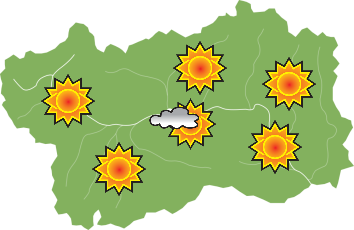
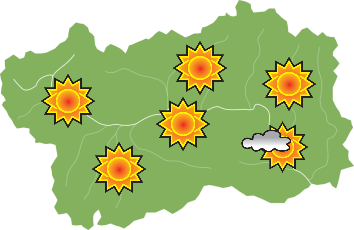
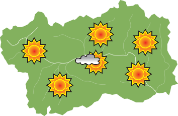
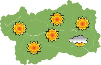
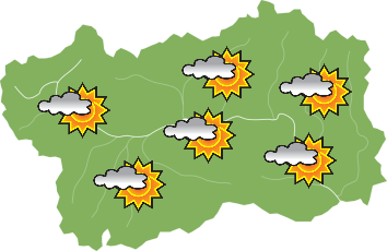
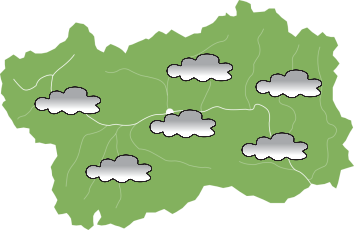
Previsioni Meteo

Meteo

sabato 10 maggio

sabato 10 maggio - Mattina
Mattina
sabato 10 maggio - Pomeriggio
Pomeriggio

domenica 11 maggio

domenica 11 maggio - Mattina
Mattina
domenica 11 maggio - Pomeriggio
Pomeriggio

lunedì 12 maggio

lunedì 12 maggio - Mattina
Mattina
lunedì 12 maggio - Pomeriggio
Pomeriggio
Previsioni dettagliate

Prenota la tua Vacanza

La data di partenza non può essere inferiore a quella di arrivo o viceversa

Cyclotour: Arvier – Usellières (Valgrisenche)

Cycling

Scopri

Cyclotour: Arvier – Usellières (Valgrisenche)

Località: Арвье, Valgrisenche

Arvier lies in a small hollow surrounded by vineyards.
In the centre of the village stands the Parish Church with its Museum of Sacred Art, the Romanesque bell-tower and La Mothe Castle, built towards the end of the 13th century. From the hamlet of Leverogne you gain access to the Valgrisenche, and climb up a series of steep hairpin bends around a peak, on top of which stands the small sanctuary of Notre-Dame de Rochefort and in the background you can see the magnificent Château Blanc glacier. Valgrisenche is surrounded by a number of peaks and glaciers. The valley is dominated by the Rutor glacier and the upper part is blocked by the Beauregard dam reservoir. The village of Valgrisenche huddles around the 19th century Parish Church of San Grato and its Mediaeval bell-tower.

Places you go through on the route:
- Arvier (745 m)
- La Ravoire 2.6 km (940 m)
- Panaval junction 9.7 km (1,505 m)
- La Béthaz 12.7 km (1,610 m)
- Valgrisenche 14,4 km (1,675 m)
- Bonne 16.6 km (1,785 m)
- “Belvedere” panoramic point 19.7 km (1,950 m)
- Usellières 22.6 km (1,755 m)


Informazioni tecniche

Periodo consigliato
Май - Сентябрь
Partenza
Arvier (Piazza IV Novembre)
Arrivo
Usellières (End of road, municipality of Valgrisenche)
Dislivello
1010 m
lunghezza
22,6 Km
Castello di La Mothe - Arvier

Condividi

TwitterTwitter
FacebookFacebook
WhatsAppWhatsApp
EmailEmail
Scarica i tracciati
gpx , kml
Cyclotour: Arvier – Usellières (Valgrisenche)

Vedi anche

Affreschi sulla facciata dell'ospizio per viandant
Medievel village and Hospice of Leverogne

Arvier

Архитектура

The hamlet of Leverogne presents an interesting urban development of the medieval village, with several noteworthy buildings. The village bridge was an obligatory passage to cross the gorge on the stream and access the Valgrisenche and the Col du Mont, a …
Leggi tutto
La torre cilindrica
Montmayeur Castle

Arvier

Замки и Дворцы

The castle was built in 1271 by Anselmo and Aimone D´Avise on a steep promontory over the orographic right bank of the Dora Valgrisenche, in a position dominating the entrance to the valley of the same name.

Today it is reduce to ruins, but preserves …
Leggi tutto
The sanctuary
Shrine of Rochefort

Arvier

Церкви и Святилища

The shrine of Rochefort, dedicated to Maria Ausiliatrice (Our Lady Help of Christians) was erected at the end of the nineteenth century on the headland where the castle of the Lords of Avise once stood, it was already in ruins at the end of the 18th …
Leggi tutto
..
The big bench in Arvier

Arvier

Panoramic points

Big Bench no. 178 installed near the hamlet Verney, makes it possible for you to enjoy a breathtaking view of the upper Valle d’Aosta, admiring Mont Blanc, perfectly centered between the sides of the main valley, and the imposing glacier of Château Blanc …
Leggi tutto
..
Природный заповедник Лолер

Arvier

Парки

Озеро Лолер  находится в котловине, протянувшейся вдоль левого склона долины Вальгризанш, на отметке 1175 м над уровнем моря. Его питают 3 источника и окружают заросли тростника и «вздыбившиеся» скалы (сглаженные округлые валуны ледникового происхождения) …
Leggi tutto

Newsletter - Rimani aggiornato su ogni aspetto

Iscriviti

Prenota la tua Vacanza

Prima di partire

  • Uffici turistici
  • Depliant
  • Webcam
  • Bollettino discesa
  • Bollettino fondo

Informazioni Legali

  • Privacy
  • Cookie
  • Accessibilità del sito

Social

logo LoveVdA
Pagina a cura del

Assessorato al Turismo, Sport, Commercio

logo Regione Valle d'Aosta

Regione Autonoma Valle d’Aosta
Région Autonome Vallée d’Aoste

© Regione Autonoma Valle d'Aosta
P.Iva 00368440079